Dolpo Geography: Nepal’s Remote Himalaya
Dolpo is one of the most remote and fascinating regions of Nepal. Located in the northwestern Himalayas, it feels almost untouched by modern life. Dolpo geography is very different from the green valleys and snowy peaks that most travelers imagine when they think of Nepal. With its high mountains, deep valleys, and crystal blue lakes, the land looks more like the Tibetan Plateau than central Nepal.
If you search Dolpo geography on Wikipedia, you will only find short entries with limited details. This guide goes much deeper, explaining Dolpo geography in Nepal with facts, maps, and insights that are useful for trekkers, researchers, and curious travelers.
Location and Boundaries of Dolpo
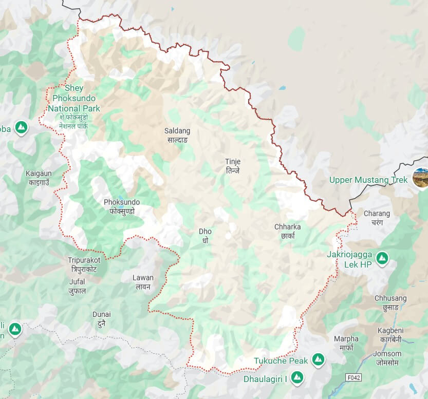
Dolpo lies in the northwestern corner of Nepal, within Dolpa District in Karnali Province. It is bordered by the Dhaulagiri massif to the south and the Tibetan Plateau to the north. Covering about 7,889 square kilometers, it is Nepal’s largest district by area but one of the least populated, with around 36,700 people.
If you look at a dolpo geography map, you notice how the region is encircled by high mountains and cut off from the rest of Nepal. The area is divided into Upper Dolpo, which is more culturally Tibetan, and Lower Dolpo, which connects to the southern valleys.
Landscape and Topography
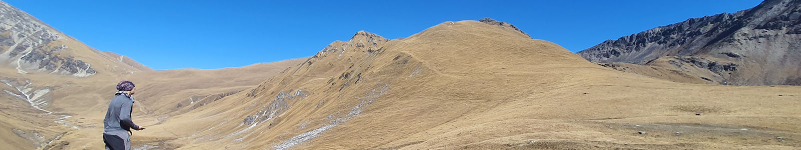
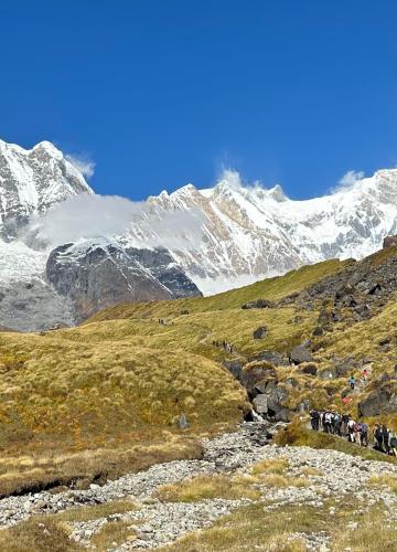
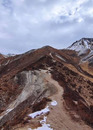
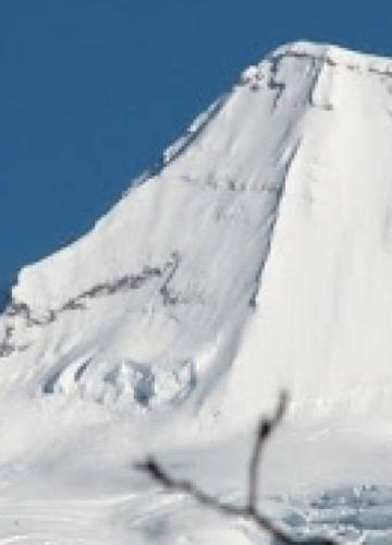
Dolpo lies in the Trans-Himalaya, a high-altitude region with dramatic landscapes. The district rises from around 2,100 meters in river valleys to over 7,000 meters at snowcapped peaks like Kanjirowa Himal. The region is also known for the mystical Crystal Mountain near Shey Gompa, a pilgrimage site for Buddhists.
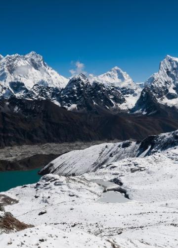
One of its most stunning features is Phoksundo Lake, also called Shey Phoksundo Lake. It is Nepal’s deepest lake at 145 meters and shines with turquoise-blue water. The Suligad River and Thuli Bheri River cut through Dolpo, creating fertile valleys like the Tarap Valley and Panzang Valley, where small villages survive against the odds.
Elevation and Altitude Zones
The elevation ranges from around 2,500 meters in the lower valleys to more than 7,000 meters on the highest peaks. These sharp altitude differences create dramatic changes in climate, vegetation, and settlement patterns. Villages in Dolpo are among the highest permanent settlements in the world.
Climate and Natural Environment
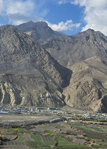
Dolpo lies in the rain shadow of the Himalayas, which makes its climate very dry. It has long, cold winters and short summers. Rain is scarce, which is why the land looks almost desert-like. The lack of rain limits farming, but it creates wide open landscapes with dramatic skies that attract trekkers and photographers.
Rivers, Lakes, and Water Systems
Dolpo is shaped by its rivers and lakes. The most renowned one is the Phoksundo Lake and it is the deepest lake in Nepal. This lake is 145 meters in depth. Its turquoise water and surrounding cliffs make it a natural wonder. Rivers such as the Suligad and Thuli Bheri carve valleys and provide life to villages, while also forming routes that connect Dolpo to Tibet and the rest of Nepal.
Featured Trip: Phoksundo Lake Tea House Trek
Ecosystem and Biodiversity of Dolpo
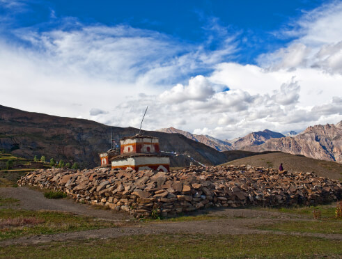
Dolpo is home to the Shey Phoksundo National Park. This is one of a Nepal’s largest protected area. Its mountain fields and rocky cliffs are home to unique wildlife like snow leopard, blue sheep (bharal), musk deer and the elusive Himalayan wolf. There are also medicinal herbs such as Yarsagumba, a common natural tonic in the high slopes during summer.
During the seasons, people covered whole mountains searching for Yarsagumba. This has also been a earning source for local peoples.
Wondering about Dolpo trekking pages, explore our Dolpo Region Packages.
Human Geography and Settlements
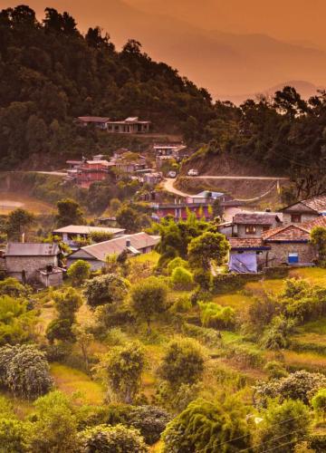
People of Dolpo have adapted to live in this difficult land. Many follow Tibetan Buddhism, and monasteries such as Shey Gompa serve as centers of faith and culture. Villages like Dho Tarap are among the highest permanently settled places on Earth.
Local life revolves around yak herding, farming barley and buckwheat, and traditional trade with Tibet. The isolation of Dolpo has preserved customs, language, and architecture that feel untouched by time.
Learn about trekking in dolpo region.
Dolpo Geography Facts
Here are some quick facts that highlight Dolpo’s unique geography:
- Area: it covers 7,889 square kilometers, the biggest district in Nepal.
- Population: About 36,700 people (2021 census), making it one of the least populated regions
- Altitude: Villages like Dho Tarap are among the highest permanent settlements in the world
- Lake: Phoksundo Lake- the deepest in Nepal is 145 meters.
- Climate: Dry, cold, and semi desert because of the rain shadow effect
- Access: No roads connect Dolpo; entry is only possible by air and trekking
- National Park: Home to Shey Phoksundo National Park, Nepal’s largest protected area
Importance of Dolpo Geography for Trekkers and Researchers
For trekkers, Dolpo offers hidden trails and untouched landscapes that cannot be found anywhere else in Nepal. On the green-blue waters of the Phoksundo Lake, to the north-blown Tarap Valley, every adventure is an adventure into an hidden area of Dolpa. For scientists and researchers, Dolpo provides rare opportunities to study high-altitude ecosystems, Tibetan-influenced culture, and the effects of isolation on the lives of people in this region.
Conclusion
Dolpo is not just a place on the map. Its geography defines a lifestyle shaped by mountains, rivers, and traditions. From Phoksundo Lake to the high passes of Upper Dolpo, the region remains one of the most extraordinary corners of Nepal. While Dolpo Geography Wikipedia gives limited information, this guide provides a deeper and more human view of its land and culture.
To discover geography of Dolpo with your personal eyes, take part with one of our treks like Dolpo Caravan Trek through secluded valleys, or visit the color turquoise waters on Shey Phoksundo Lake Trek. Individuals who need different ventures can visit the Upper Dolpo Trek to see the other beautiful sceneries of Nepal.
All About Dolpo
Dolpo Region | Dolpo History | Dolpo Himalaya | Dolpo People & Ethnic Groups | Dolpo Flora & Fauna | Bon Religion in Dolpo | Shey Festival | Shey Gompa | Shey Phoksundo National Park | Phoksundo Lake | Dolpo Yarsagumba | Dolpo Caravan Trade
Popular Dolpo Trekking Packages
Upper Dolpo Trek | Lower Dolpo Trek | Beni Dolpo Trek | Phoksundo Lake Tea House Trek | Phoksundo Bon Cultural Trek | Mugu Dolpo Trek | Jumla Kagmara Dho Tarap Culinary Trek
FAQs
Where is Dolpo located in Nepal?
Dolpo is in the northwestern part of Nepal, within Karnali Province. It borders Tibet to the north and is part of Dolpa District, the largest district in the country.
Why is Dolpo geography unique?
Dolpo combines high Himalayan peaks, deep valleys, and dry desert-like terrain. Its location in the rain shadow of the Himalayas makes its climate and landscape very different from most parts of Nepal.
What is the climate of Dolpo like?
The climate is dry and cold. Winters are long and freezing, while summers are short and mild. The lack of rain creates a semi desert environment.
What natural features define Dolpo geography?
Phoksundo Lake, Shey Phoksundo National Park, Tarap Valley, and the Dhaulagiri massif are the most defining natural features of Dolpo.
How can you reach Dolpo?
Dolpo has no road connections. Most visitors fly to Juphal airstrip in Dolpa District and then trek for several days to reach the villages and valleys.

Leave Your Comment